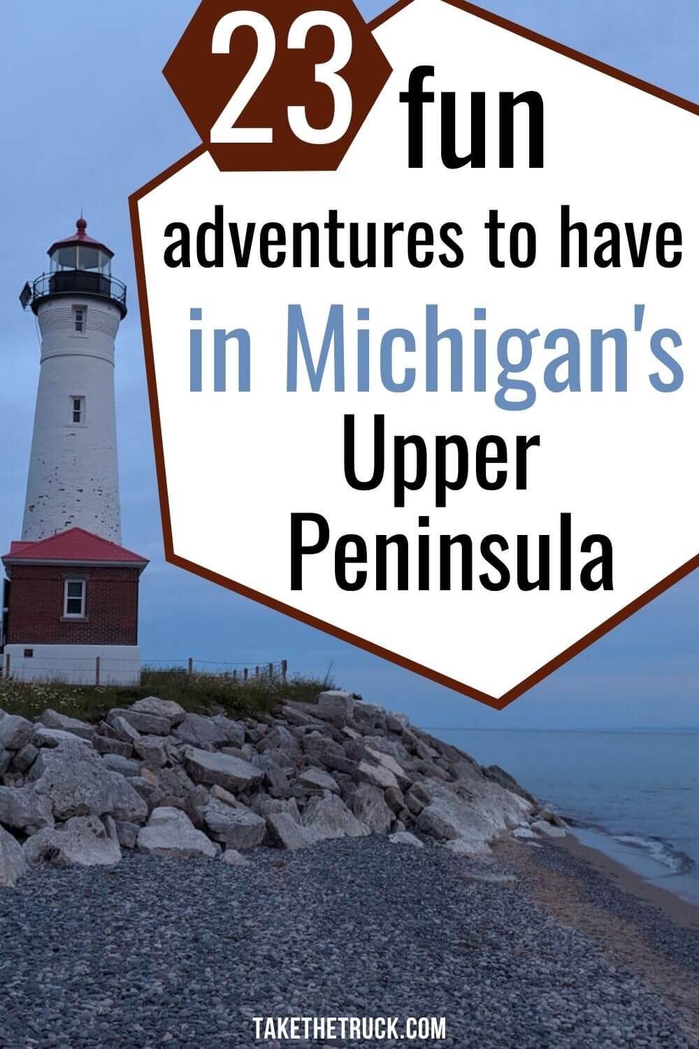
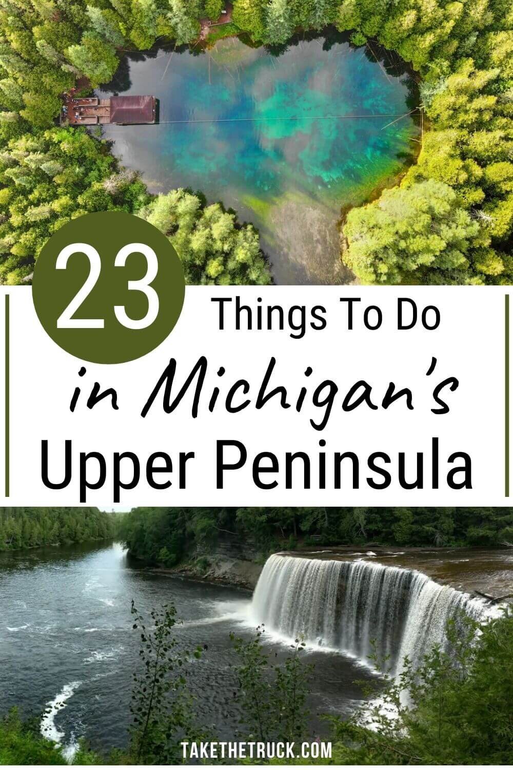
Top 23 Things To Do In the Upper Peninsula of Michigan

There are so many fun and unique things to do in the Upper Peninsula of Michigan! Whether you want to explore the remote and rugged wilderness, have an off-road adventure, hike the shorelines of 3 of the 5 Great Lakes, or just relax on a sandy beach and soak up the sun, the U.P. has something for everyone.
In this post we’ve compiled 23 of the best things to do in the U.P. to help you plan your next adventure to this beautiful, historic, and lesser-known part of the country.
We’ve also got a post all about free camping in Michigan’s Upper Peninsula, so head there next if you’re taking a budget road trip and are set up for wild camping!
23 Things To Do in the Upper Peninsula
Stare at the Mackinac Bridge
If your Upper Peninsula Road Trip is beginning by crossing the Mackinac Bridge, first stop at Alexander Henry Park to see it!
Walk across the street to grab some ice cream from the Lighthouse Party Store, then dip your toes in the water, stare at the Mighty Mac, and even walk underneath it.
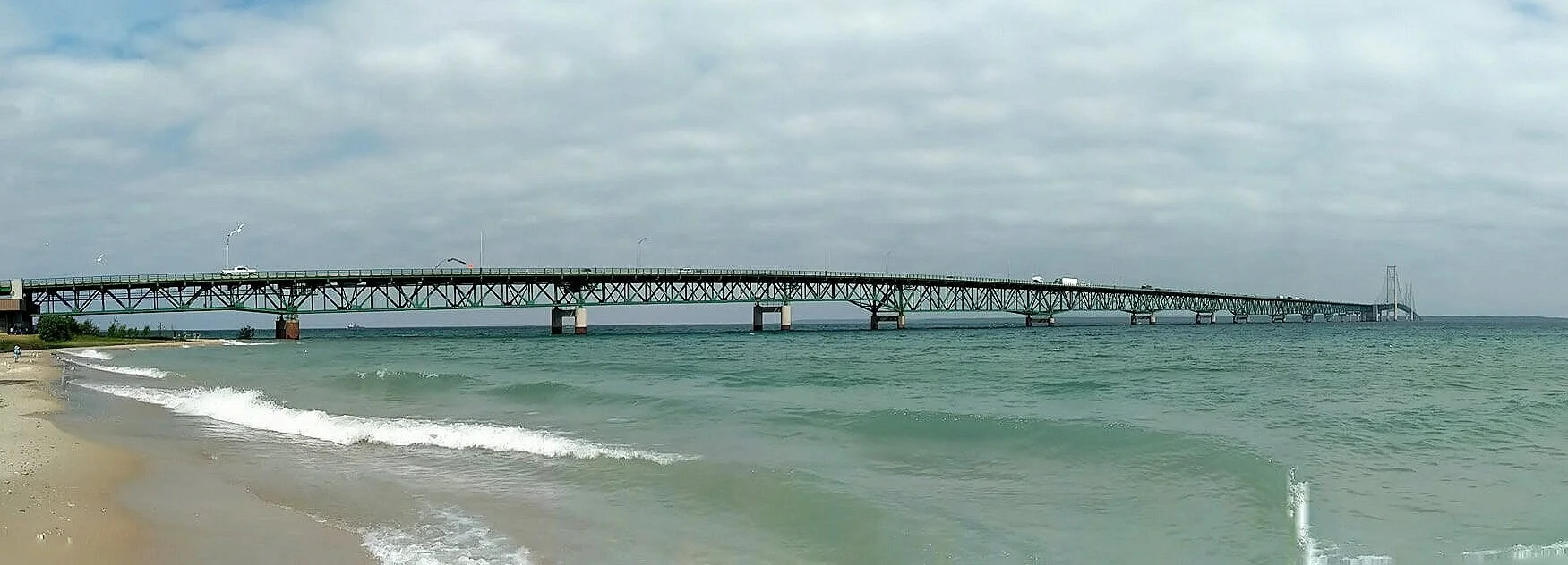
The 5 mile long Mackinac Bridge is America’s longest suspension bridge. It crosses the straight that connects Lake Michigan and Lake Huron, and the middle stands about 200 feet (61 m) above the water. The Mighty Mac is designed to withstand high winds, and under extreme circumstances, it’s middle is able to move a full 35 feet (11 m)!
GPS Coordinates: 45.787318, -84.730219
Mackinac Island

Because of both our low budget and low bandwidth for crowds of people, a visit to Mackinac Island did not make the final cut of things to do when in the U.P. But, making a stop at this old timey island has made our list for you today because just about every living person says it should.
We hear there’s something for everyone if vacationing on Mackinac Island, whether you’re interested in history, are drawn towards nature, or just want an unusual place to relax and enjoy new experiences.
If traveling back in time and exploring this unique island is for you, this site might help in your planning an awesome visit!
GPS Coordinates: 45.869917, -84.627675
Castle Rock
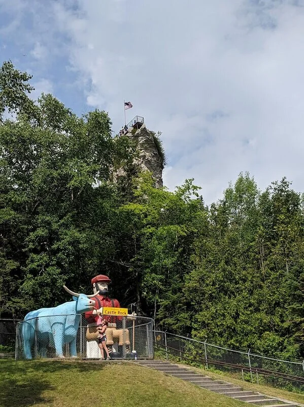
Castle Rock is located in St. Ignane, just north of the Mackinac Bridge. It’s worth a quick 20 minute stop if you’re wanting to stretch your legs, and when we visited it only cost $1/person.
Be warned, before getting to the rock you’ll first be funneled through a store full of trinkets and the area is pretty commercialized and touristy.
But climbing all those steps to the top is a nice way to move around after being on the road, and the view from the top is a nice reward for your efforts!
GPS Coordinates: 45.910717, -84.741565
Drummond Island

Our visit to Drummond Island was one of our favorite things to do in the U.P.
The island is located off the very eastern side of the Upper Peninsula, and is best known for its ATV and ORV trail system as well as its pristine beauty.
After taking the ferry over (an experience in and of itself), we highly recommend you stop at the Visitor’s Center. The staff is extremely knowledgeable and helpful in pointing groups and families in the right direction depending on interests, vehicle and driver capability, and time limitations. This is also where you can pick up your ORV permits!
Toyota enthusiasts be warned - this island belongs to the Jeeps. We saw multiple groups while exploring the trails throughout the island. It’s also a good idea to brush up on your trail etiquette before exploring any of the Drummond Island ORV trails.
You can find the Drummond Island Ferry Schedule: HERE
You can find the Drummond Island ORV/ATV Trail Map: HERE
We highly recommend the north route to “The Steps” at Marble Head - it’s a beautiful, bumpy, and fun trail provided you have a capable 4x4 that’s been given the green-light by the staff at the visitor’s center.
GPS Coordinates: 45.985874, -83.813563
Soo Locks
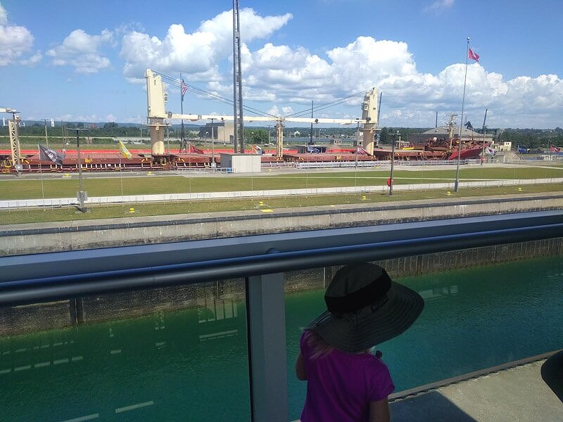
If you’re near Sault Ste. Marie and looking for a unique (and free!) thing to do in the Upper Peninsula, check out the Soo Locks.
These gravity fed locks with roots dating back to the mid 1800’s allow 1,000 foot (305 m) freighters (plus thousands of smaller vessels) to be lifted and lowered the 21 feet (6.4 m) necessary to safely pass from Lake Superior to Lake Huron.
You can step right up to the action on a covered observation platform, although -be warned- the action will feel like it’s happening in slow motion. So don’t expect the average little one to be highly entertained during the whole process of moving a boat from one elevation to another!
But there’s also an informational visitor’s center, beautiful grounds to explore, and if you’re really into it, you could take a boat tour of the Soo Locks to experience them first hand.
GPS Coordinates: 46.502004, -84.350665
Great Lakes Shipwreck Museum & Whitefish Point Lighthouse

The very north eastern point of the U.P., Whitefish Point, is home to both the Great Lakes Shipwreck Museum and Whitefish Point Lighthouse, and both rank as top things to do when visiting the Upper Peninsula.
Whitefish Point is one of the most loved Lake Superior Lighthouses, and through the use of artifacts, video, and exhibits, The Great Lakes Shipwreck Museum tells the story of the treacherous Lake Superior and the ships and lives she’s taken.
Both are seasonally open and require an admission fee. There’s also a boardwalk from the museum to Lake Superior with beach access, a lifeboat rescue station with a restored surfboat, and a museum store.
GPS Coordinates: 46.782999, -84.955505
Visit Tahquamenon Falls State Park
Visiting this well-known U.P. waterfall, Tahquamenon Falls, could be a quick stop just to view the falls, or a multi-day camping trip to explore all the state park has to offer.
There is an entrance fee, as Tahquamenon Falls is in the Michigan state park system, and the main area is pretty developed. The short .4 mile (.6 km) walk to the upper falls is paved and a lot of picnic areas are scattered around. There’s a good sized store, a restaurant, and a small wildlife exhibit near the main parking area.
The Tahquamenon waterfall itself is the gem of the park, being one of the largest waterfalls east of the Mississippi. It’s over 200 feet (60 m) across and drops close to 50 feet (15 m).

Throughout the entire 50,000 acre state park, however, you’ll find 4 campgrounds, miles of hiking trails, small lakes, and a huge variety of wildlife. So if you’re looking to extend your stop it’ll be easy to do.
GPS Coordinates: 46.609952, -85.206308
Crisp Point Lighthouse
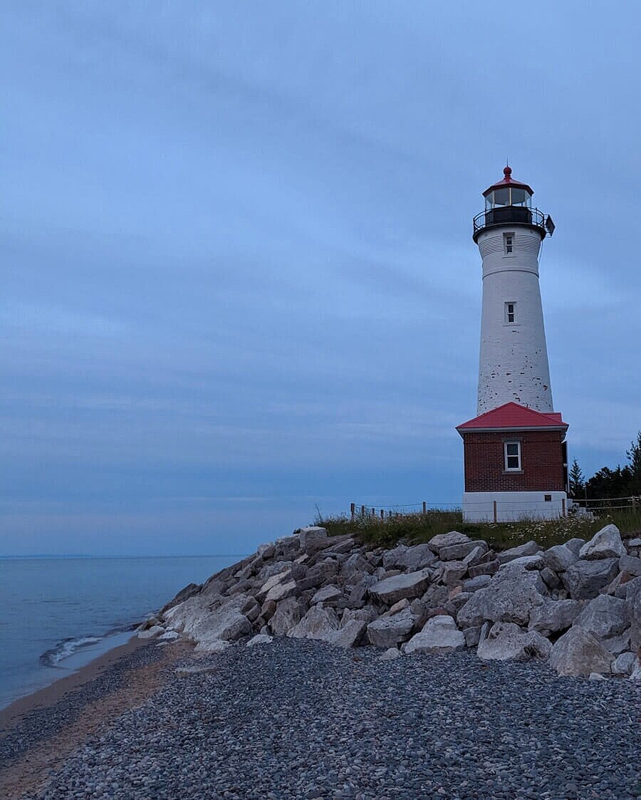
After several more developed stops during your Michigan road trip, you might be ready for a quiet drive to Crisp Point Lighthouse. Visiting this Lake Superior lighthouse was another of our favorite things to do in the U.P.!
And that's probably because getting there requires an 18 mile (29 km) drive over dirt roads (right up our alley!), which works to keep this place less traveled! Beauty AND solitude!
The shoreline is covered in colorful rounded rocks, smoothed by the waves of Lake Superior. Boardwalks help you get around to explore, and this Upper Peninsula lighthouse is left open for those who would like to take a self-guided tour.
Twisting up-up-up to the top of the lighthouse is a unique experience, and the views of Lake Superior and the shoreline are perfect.
Note: It is important to check road conditions before heading towards Crisp Point Lighthouse. Although the road is pretty well maintained, it can become impassable after heavy rain. And it’s a long way to drive just to have to turn around.
Also know that you likely won’t have cell service during this part of your trip (and there are multiple roads and turns to get to the lighthouse), so have a trusted map, gps, and solid directions before heading out.
And! Know where you’re heading when leaving the lighthouse so you’ll have those directions as well. Otherwise you might end up on a snowmobile trail at midnight...not that we’d know from experience or anything...
GPS Coordinates: 46.753073, -85.257253
See the Northern Lights

Did you know it's possible to see the Northern Lights from the Upper Peninsula?! Well, we didn’t before taking our Michigan road trip, but now YOU do!
Planning your trip for April, October, or November raises your chances of seeing this phenomenon, and you’ll want to head to a location on Lake Superior with no light pollution, like Whitefish Point, Picture Rocks, or Copper Harbor.
Pictured Rocks National Lakeshore

Dunes, waterfalls, sparkling inland lakes and streams, sandstone cliffs towering up to 200 feet above the water, a lighthouse, boat tours, canoeing, kayaking in sea kayaks, deep forests, arches, mineral stained streaks decorating the cliff faces, camping, beaches, hiking, visitor centers - there’s something for everyone at Pictured Rocks National Lakeshore!
If your budget allows, a boat tour of Picture Rocks is the best way to view the cliff’s unique erosion and coloring. Or if you’re able to bring or rent sea kayaks and go out on your own, that would be a worthwhile U.P. adventure as well!
However, if you aren’t able to get out on the water, there are multiple hiking trails that get you up close and personal to some really cool stuff.
Here’s our top recommendations when traveling through Pictured Rocks from east to west:
Sable Falls: ½ mile (.8 km) hike to the falls with an additional ½ mile (.8 km) hike to the sand dunes and a creek that enters Lake Superior. Plan for some time to explore and relax on this rocky beach!
Chapel Rock Trail: This hike makes our top 10 list of all-time favorite hikes!
It’s a 6 mile (9.7 km) loop, beginning in a really peaceful shaded forest. After about a mile the trail takes you past Chapel Falls, and in two more miles of mostly level hiking you’ll be at Lake Superior and the famous Chapel Rock.
This thing is incredible. It’s a sandstone outcropping with a lone pine standing strong, its extensive root system keeping it connected to the mainland.
From there you’ll walk along a cliff above Lake Superior for a short time before coming to the mouth of a creek flowing into Lake Superior. Next you can easily find the sandy Chapel Beach and enjoy some play and relaxation time before making the 3 mile trip back to the parking lot.
The final three miles aren’t as exciting as the first three. And there are several spots where the trail narrows quite a bit and you’ll likely question if you are still on the main trail. You are (hopefully). Keep moving forward.
Note: Doing the Chapel Basin Loop by connecting in with Mosquito Falls (total of over 10 miles/16 km) would make this hike even more exceptional if you’ve got the time.Miners Castle Scenic Overlook: This is just a short walk to 3 viewing platforms from which you can see some cool bluffs and look out over 1/10th of the world’s fresh water! What…?!
Miners Falls Trail: This is a short 1.2 mile (1.9 km) hike through forest to get to a pretty U.P. waterfall. You’ll see lots of neat trees and exposed roots along the way.
Worth noting- when looking at a map, all of the points of interest appear to be pretty close to each other. But know that the drive between each is further than it looks - plan accordingly.
GPS Coordinates: 46.423876, -86.623865
Seney National Wildlife Refuge

If you haven't gotten enough of the area wildlife, Seney National Wildlife Refuge can help!
The 95,000 acre refuge is free to visit and contains a 7 mile marsh drive, biking trails, and nature trails through wetlands, forests, and meadows, as well as paddling, hunting, fishing, and birding opportunities.
Something for everyone!
GPS Coordinates: 46.281039, -85.927777
Palms Book State Park
Palms Book State Park is a huge freshwater spring that’s certainly worth a stop if looking for things to do on the southern side of the U.P.
This spring is crystal clear, 200 feet (61 m) across and 40 foot (12 m) deep, a constant 45 degrees F, and full of really big trout (no fishing allowed though!).

And a self-operated observation raft gets Palms Book State Park visitors right out over the top of the water!
GPS Coordinates: 46.004365, -86.381951
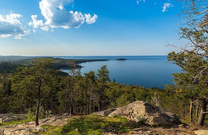
Presque Isle Park in Marquette

If you find yourself looking for outdoor things to do in Marquette, check out Presque Isle Park!
The park is a 323 acre forest-covered peninsula jutting out into Lake Superior and has been left mostly untouched, preserving the natural beauty.
There’s a 2.2 mile (3.5 km) paved loop around the peninsula meant for vehicles, bikes, or hiking with multiple places to park and get out to the water’s edge. And doing that is a must!
Leaving the main trail, you’ll find multiple overlooks to watch the Lake Superior waves crashing far below, places to explore beaches and rock formations right at the water’s edge, and if you time it right - you can even catch a breathtaking sunset from Sunset Point.
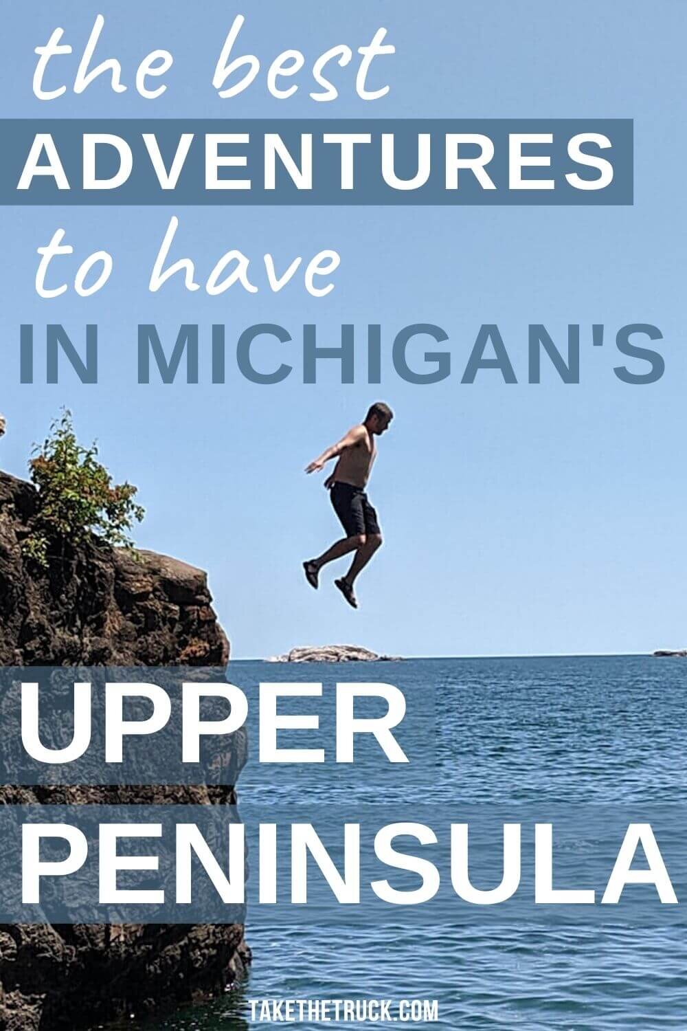
Our favorite part of our Presque Isle Park visit was exploring the rock formations known as the Blackrocks, found on the western side of the peninsula. At Blackrocks Cove you can climb right out onto the rocks and enjoy Lake Superior up-close-and-personal.
And if you’re wanting to cool off or are seeking a thrill, do some cliff jumping! Plunging into Lake Superior is super invigorating and a memory worth making!
GPS Coordinates: 46.587034, -87.382537
Sugarloaf Mountain Hiking Trail
The Sugarloaf Mountain Trail is one of the more popular places to hike near Marquette. It’s a short 1 mile (1.6 km) round trip hike up to 3 viewing platforms where you can take in expansive views of Lake Superior.
At the trailhead you’ll notice two routes, one labeled easy and the other labeled hard - neither is considered very difficult though. The easy route has you climbing stairs, while the harder route has you weaving up the mountainside.
We recommend that you take the harder route up (it should only take you about 20 minutes to get to the top of Sugarloaf Mountain) and come down the easy way. Head over to this post for a super detailed description of this hike!
GPS Coordinates: 46.603325, -87.459872
Canyon Falls Trail
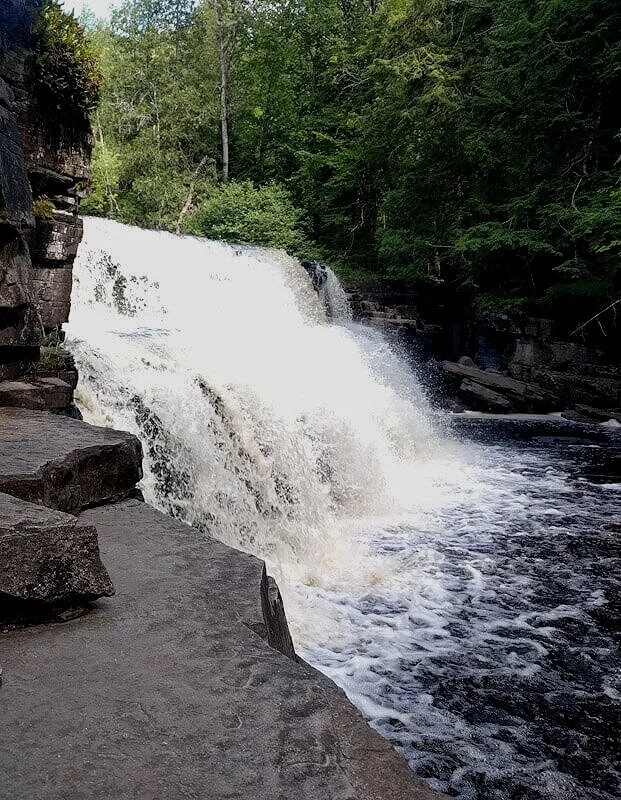
This recommendation comes straight from Michigan and Wisconsin natives, Brad and Eileen, who hosted us for the most delicious breakfast and a fun afternoon!
Canyon Falls Hike is found at a rest stop right off US 41 and is much less commercialized than any of the other Upper Peninsula waterfalls we visited. The about 1 mile (1.6 km) and mostly level trail parallels the Sturgeon River before ending at Canyon Falls.
The hike along the river is enough to make this adventure awesome with all the shelf-like rock jutting out into the river, offering places to explore, play, and relax. And the waterfall at the end just adds to the whole experience! For more details before heading that way, head over to this post.
GPS Coordinates: 46.627150, -88.470971
Estivant Pines Nature Sanctuary

The Estivant Pines Nature Sanctuary protects an old growth forest filled with trees that are hundreds of years old and If you know where to look, you can find white pines with a diameter of 3-5 feet (.9-1.5 m)!
You can hike between 1 mile (1.6 km) and 2.5 miles (4 km) in this old growth forest, depending on what trail combinations you opt for between the two loops offered. The trail is mostly level but rated moderate because of the crazy exposed roots and rocks along the pathway.
For the adventurous - with a bit of planning and the proper gear necessary to cross a swamp and river, you could take a side trail out to the Fallen Giant, a massive white pine that fell in the 1980s.
GPS Coordinates: 47.446099, -87.877595
Fort Wilkins State Park

If you’re wanting to take in some history while looking for things to do in the Upper Peninsula, check out Fort Wilkins State Park.
Originally built in 1884, this now preserved fort was intended to keep law and order during the copper rush. Today, it tells the story of what life was like in the mid 1800’s on this rugged and remote northernmost frontier.
As a fun bonus Fort Wilkins staffs the very informative but always slightly uncomfortable costumed-and-won’t-leave-character actors performing historical reenactment.
GPS Coordinates: 47.467308, -87.869754
Brockway Mountain Drive

After spending time hiking and driving through the dense forests of the U.P., Brockway Mountain Drive offers a welcome wide open drive and expansive view. The drive is kinda slow going, but the road is well maintained.
From the top of Brockway Mountain, you’re rewarded with an incredible 360 degree view. And when we were there it was just windy enough to keep the bugs away! If you’re able to time it right, you can watch the sunset over Lake Superior before heading on.
And bonus, you might actually have cell service up there!
GPS Coordinates: 47.467229, -87.898315
Bare Bluff Hike

If you’re interested in getting off the beaten path while in the U.P., this wilderness trail comes highly recommended! Just know that the road going in to Bare Bluff Hike can be rough, so read reviews before deciding if it’s right for you and use your best judgement!
The hike is a 3 mile (4.8 km) loop trail, and going clockwise around the loop is recommended for the average hiker. If you’re looking for a challenge you could go counterclockwise, and if you’re hiking with kiddos or grandparents, you might consider reaching bare bluff in a clockwise direction and then going back down the way you came.
Once at the lookout, Lake Superior will be about 500 feet (152 m) below and the tip of the Keweenaw Peninsula will be jutting out into the lake off to your left.
Note: The official name of the trail is the Russell and Miriam Grinnell Memorial Nature Sanctuary.
GPS Coordinates: 47.397278, -87.911561
Quincy Mine

Visiting the Quincy Mine made our list of things to do in the Upper Peninsula but got eliminated because we’re cheap and we had our timid 3 year old with us!
But if you’re interested in mining history, the full tour even gets you underground with a guide.
GPS Coordinates: 47.136897, -88.575262
Visit Isle Royale National Park

Visiting Isle Royale National Park is on our bucket list, and will likely remain there for quite a few years.
First of all, you can only access the island by seaplane or boat. And then you have to be prepared to rough it in the wilderness for the duration of your stay, as civilization hasn’t totally encroached on this rugged island.
But with the proper backpacking gear and a budget that allows, this isolated Lake Superior island brings all the adventure - from backpacking and hiking, to boating, kayaking, or canoeing, and all with a scenic backdrop that is unparalleled (or so we hear).
While day trips are an option, we’d recommend planning a longer multi-day wild camping trip to be able to fully experience Isle Royale (and to maximize the return on those transportation fees to and from the island).
GPS Coordinates: 48.020672, -88.909977
Visit a Brewery or Winery!

Check out these guides for finding a great brewery or winery in whatever region of the Upper Peninsula you find yourself in - there are so many good ones to choose from!
Porcupine Mountains Wilderness State Park
This place is huge - roughly 60,000 acres huge. It would be easy to spend an extended amount of time in the backcountry of the Porcupine Mountains and only cross paths with a handful of people.
The easily accessible parts of the park that most visitors find themselves in are divided into three main scenic areas, and we’ve got a recommendation for each area:

Lake of the Clouds: Take the short walk to the Lake of the Clouds Overlook, and possibly extend that by hiking on part of the Escarpment Trail. On a clear day, the views here are perfect.
Summit Peak: Take the short ½ mile (.8 km) hike over both trail and elevated boardwalk to scale the summit peak observation tower.
Presque Isle River: Hike the waterfalls loop, connecting both the West River Trail and East River Trail in a 2.3 mile (3.7 km) loop. You’ll see multiple cascading waterfalls and tons of really cool trees and root structures.
GPS Coordinates: 46.829115, -89.622059
There are so many things to do in the Upper Peninsula of MIchigan! If you find yourself taking a road trip or long weekend exploring parts of the U.P., we hope these places to see and experience can help you in your planning. Head over to this post if you want help finding a bunch of free campsites along the route!
And for those of you already familiar with the U.P. - let us know in the comments section what you think should be added to the list!
Please SUBSCRIBE to get our new posts sent right to your inbox, and, as always, thanks for reading!
Related Posts:
Pin this for your Upper Peninsula road trip planning!
We’d appreciate a share!