A Dozen Awesome Things To Do in Northern California

If you’re looking for things to do in Northern California, you’ve come to the right place!
For this post, we’ve rounded up a dozen places to visit in Northern California, stretching from the California/Oregon border to the Tahoe National Forest.
All of these stops are inland, away from the coast, but if you’re looking for things to do along the Northern California coast, we’ll soon have a post out about that too!
12 Things To Do in Northern California
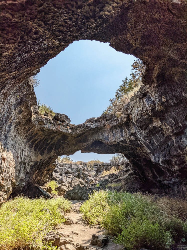
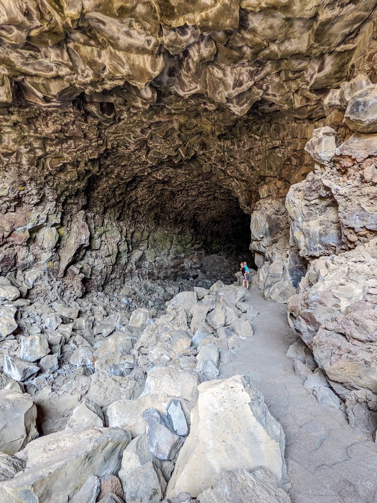
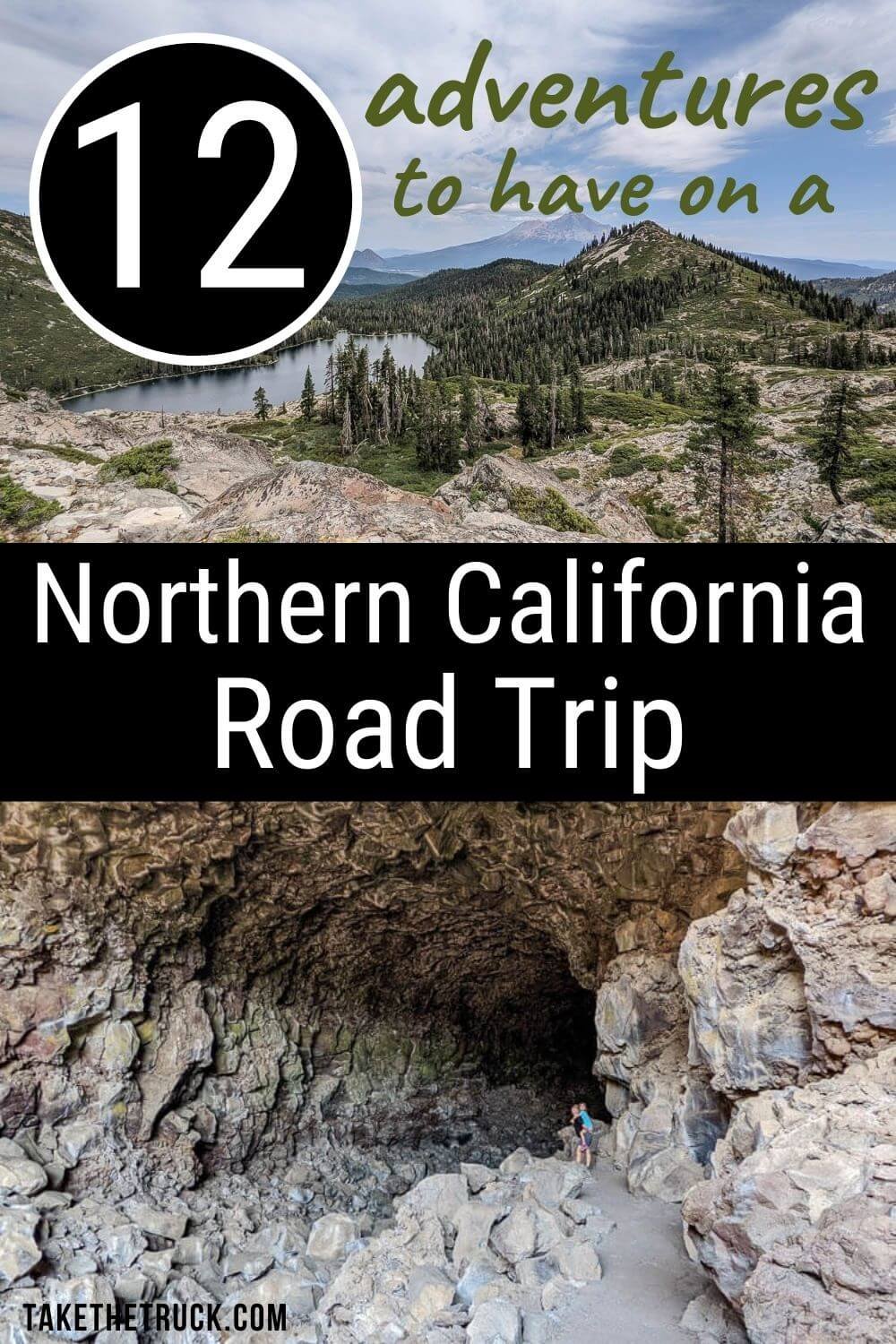
1. Lava Beds National Monument
GPS Coordinates: 41.77502736870512, -121.50679387964554
Lava Beds National Monument is a fun and unique thing to do in Northern California. It’s near Tulelake in the very northern part of the state. The main attractions here are the caves that have formed over the past half million years as lava flowed through the area before cooling.
There is a $25 vehicle entry fee at Lava Bed National Monument, and one primitive campground (Indian Well Campground), which rarely fills, with sites costing $10/night. When you first arrive, you’ll be asked to go to the Visitor’s Center to get your free caving permit.
The National Park website has the caves divided into least challenging, moderately challenging, and most challenging, so you can easily choose which match your comfort and fitness levels. If you plan to explore the most challenging caves you’ll need to either bring or rent the appropriate gear.
There are also excellent hiking trails throughout the park.
Here are our personal favorite caves to have on your list!
Mushpot Cave - a great place to start, especially if you have younger kids or hesitant participants, because it has lighting throughout and is an easy stroll
Crystal Ice Cave - has some unique ice formations
Sunshine Cave - the roof is missing so some plants grow inside the cave
Valentine Cave - interesting columns to walk around and lots to explore
Hopkins Chocolate Cave - natural bridges to explore at the entrance and a “chocolate” looking floor soon after entering - we only explored around the entrance
Skull Cave - this one is cool, with steps going down, down, down as the temperature drops; if you make it to the bottom you’ll see a ram skull frozen in the ice floor.
Check out the national park website for more info.
2. Mount Shasta
GPS Coordinates: 41.352795, -122.291878
As you take your northern California road trip, Mount Shasta can’t be missed at over 14,000’ high and typically snow capped!
Seeing Mount Shasta in the distance as you look for things to do in northern California is one thing, but camping at her base is another thing! Route A-10 goes part of the way up Mount Shasta, and you’ll find free dispersed camping all over the place.

We found a perfect spot, after a good bit of searching, with beautiful views of the mountain, and decided to hunker down and camp for the whole weekend.
3. Castle Lake to Heart Lake Hike
GPS Coordinates: 41.23090557331348, -122.37999191084229
This is a quick hike worth adding to your itinerary of things to do in Northern California. It’s short - only a little over 2 miles - but most of that is hiking up, up, up in elevation!
You’ll park at Castle Lake, and if you’re visiting in the summer, it might feel crowded. But don’t worry - most people stay near the parking area to swim in the lake, so the further you explore up the trail the more solitude you’ll find.
Follow the trail around Castle Lake and then head uphill toward Heart Lake. During our visit, the trail was marked and easy to follow. But we had read beforehand that people often lose the trail so have a downloaded map and know where you’re going.
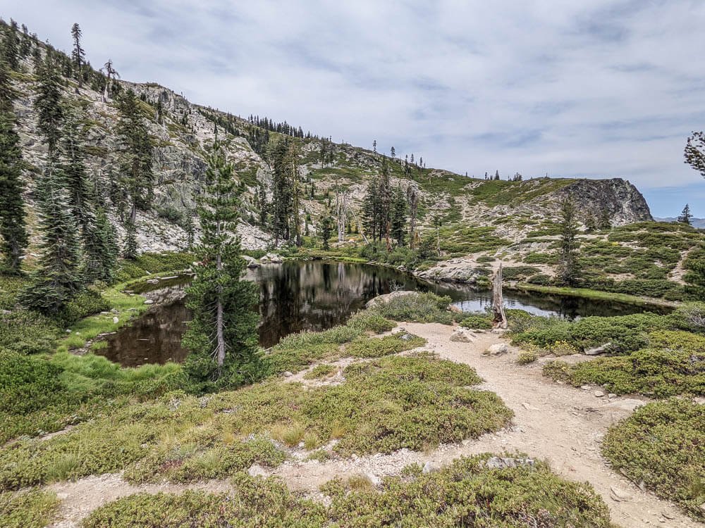
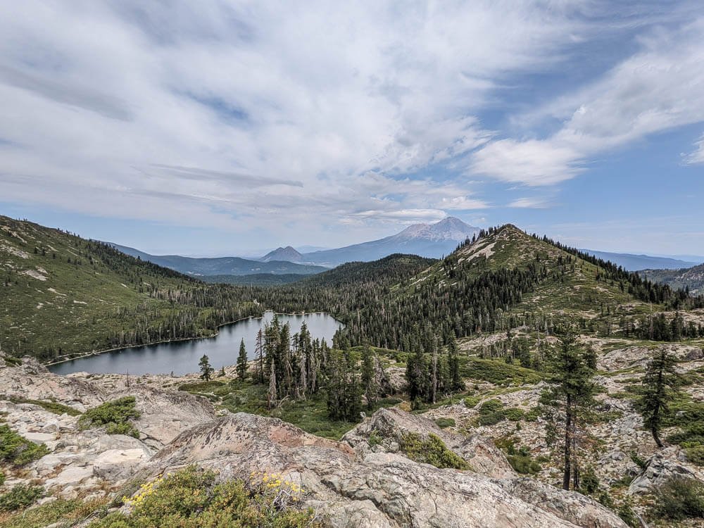
Once you reach the top and see Heart Lake (named so because of its heart shape), you’ll see that your effort wasn’t so much for the visit to little Heart Lake, but for the views!
From Heart Lake you can walk out to see Castle Lake below with Mount Shasta towering in the background. It’s a great spot to enjoy a picnic lunch as you soak it in!
4. McCloud Middle Falls
GPS Coordinates: 41.244558645379286, -122.00854165842902
McCloud Falls is actually made up of an Upper, Middle, and Lower Falls that you can hike between. This is a super fun place to visit in Northern California!
We only visited McCloud Middle Falls. The river is at the bottom of a canyon, so after parking, you’ll hike down a well developed trail with some switchbacks to get to the falls. It can get crowded, so arrive before noon.

McCloud Middle Falls are really wide and beautiful. Cliff jumping, swimming, wading for the little ones - and even with quite a few people around we were able to find our own little space.
If you do want to visit the Upper and Lower Falls, you can either hike between them all or park in designated spots above each waterfall.
Lower Falls tends to get the most crowded because there are jumping platforms for swimming. And although the river water is cold, most people can acclimate to it if they really want to swim!
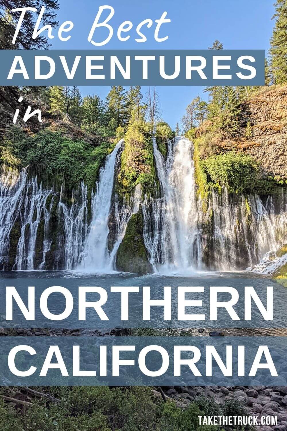
5. Burney Falls State Park
GPS Coordinates: 41.011843, -121.650600
Burney Falls is a California State Park that should definitely make your list of things to do in Northern California! The 129’ Burney Falls flows at a rate of 100 million gallons every day, and it's breathtaking.
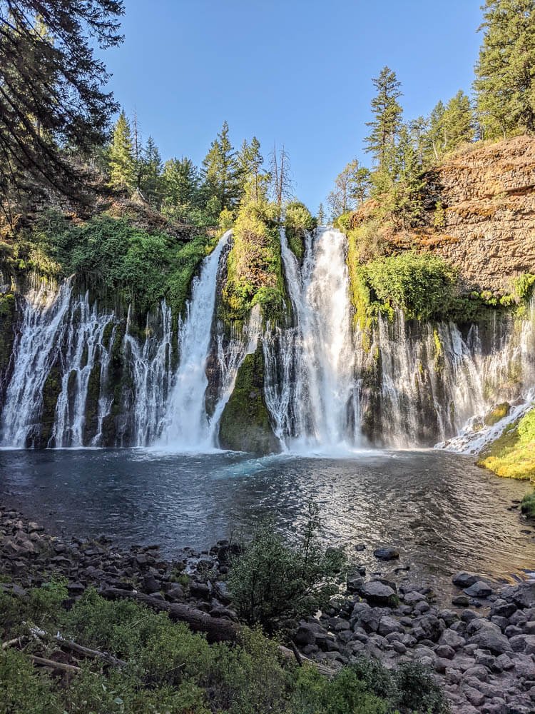
Because it's a state park, there is a small entrance fee. It's pretty developed with a small camp store, a paved trail down to the falls, and a large campground. Outside of the main attraction, there are about 5 miles of hiking trails to explore.
On a relatively warm day, we were pretty cold once near the falls because of the mist and wind direction. Dress in layers so everyone can take their time and really soak in Burney Falls!
The website warns of increased visitation and parking becoming full on summer weekends, causing visitors long wait times. Though we haven’t experience this on either of our visits, plan to arrive early and avoid peak summer weekends if possible! Check out their website for more information.

Bonus: The infamous train bridge from the movie Stand By Me is right down Highway 89 at the entrance to Dusty Campground, and is a neat place to visit in Northern California if you’re a fan of the movie. It’s located here if you want to check it out.
6. Shasta Dam
GPS Coordinates: 40.7140083520338, -122.41761048674508
Shasta Dam, outside of Redding, is an engineering feat. Completed in 1944 during WW2, the Shasta Dam took 7 years to build. Millions of tons of rock were excavated, a 9.6 mile long conveyor belt delivered gravel from Redding, and there are 1,300 miles of pipe inside the dam walls - used to run cold water throughout the walls to cool down the curing concrete during construction.
It’s pretty impressive to explore in person, making it a great place to visit in Northern California!
At the time of this writing, the Visitor’s Center is open during the weekdays, however, the guided tours inside the dam and powerplant are unavailable. Visitors can do a self-guided walking tour across the top of the dam. Check out their website for the most up-to-date information.
7. Turtle Bay Exploration Park
GPS Coordinates: 40.591214753137116, -122.37639453092766
Turtle Bay Exploration Park in Redding is a 300 acre cultural center found along the Sacramento River. It’s a very kid-friendly place to visit in Northern California, with over 10 miles of pathways and trails, a museum with rotating exhibits and 35,000 historical artifacts, botanical gardens, a wildlife center with over 50 living animal species, outdoor playgrounds with water features, and the world-famous Sundial Bridge.
There is a fee to enter, but a family could easily spend an entire day here exploring! Visit their website for the most up-to-date information.
8. Lassen Volcanic National Park
GPS Coordinates: 40.43798295894247, -121.53383127325982
Lassen Volcanic National Park contains over 100,000 acres of things to do in Northern California. You’ll find clear mountain lakes, meadows of wildflowers, breathtaking vistas, bubbling pots of mud and hissing cracks in the earth, boiling pools, and numerous volcanoes.

Bumpass Hell Hike, Kings Creek Falls, and Lassen Peak are all hikes worth looking into, and there are many more to enjoy! Stop in at the visitor’s center for specific recommendations for your group.
There are campgrounds in Lassen Volcanic if you’re looking for a multi-day visit. Some areas of the park have limited access because of the Dixie Fire in 2021. Check the website for up-to-date information.
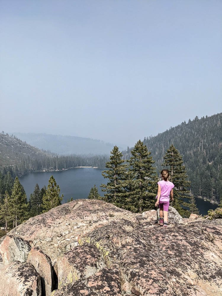
9. Upper and Lower Sardine Lakes
GPS Coordinates: 39.615050810975035, -120.62647620952177
Considered some of the most scenic lakes in the Sierra, the Upper and Lower Sardine Lakes should make the cut of things to do in Northern California! These mountain lakes are found in the Tahoe National Forest, with the Sierra Buttes as a gorgeous backdrop.
Lower Sardine Lake is the more visited of the two and is home to Sardine Lake Resort. They’ve got a restaurant, as well as boat and cabin rentals. Because Lower Sardine is such a prized fishing spot, swimming isn’t allowed in these crystal clear waters.
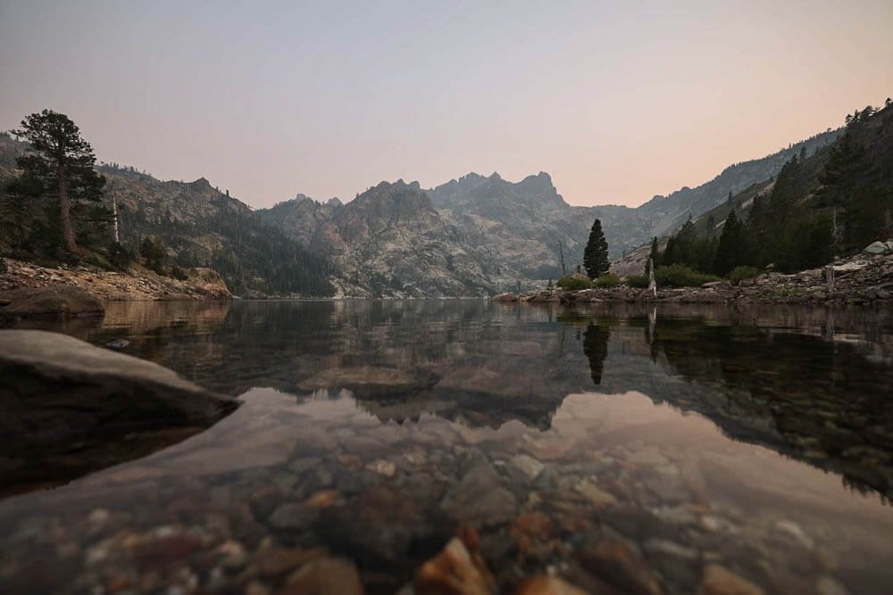
Upper Sardine Lake can only be accessed by taking a rough 4x4 road, or hiking up that same road from the parking area at Lower Sardine. You’ll be able to dive right into the cool waters of the Upper Sardine, and can easily spend the whole afternoon exploring this gem of a lake. While you’re there look up at the Sierra Buttes and see if you can spot the firetower!
10. Sierra Buttes Lookout Trail
GPS Coordinates: 39.59375592867664, -120.6472300021175
Did you spot the firetower when you were swimming in Upper Sardine Lake?! Now it’s time to get up to the top of the tower and enjoy the views looking down!
The Sierra Buttes Lookout Trail is on our list of things to do next time we visit Northern California! It’s a 4.8 mile out and back trail with about 1,500 ft of elevation change. The hike has periods of both shade and sun, and the views are breathtaking all throughout the hike, not just as a reward at the end.
Once you reach the base of the firetower, take a little snack break, check your laces, and then climb the about 200 steps to the top of the tower! We hear that you won’t regret this extra effort!
The Sierra Buttes Lookout Trail is best to hike between June and October, as it can be dangerous when snow covered if you don’t have the proper gear. There are several different trailheads, depending on which way you’re coming in, and they all link up to the main trail. So do your research ahead of time to know which access makes the most sense for you!
11. Local Sierra City Stops
GPS Coordinates to the Picnic Area: 39.565883005442046, -120.63557524238192
Sierra City Picnic Area: If you need wifi for work, or would really appreciate a shower, stop in at the Sierra City Picnic Area. It’s located on the Pacific Crest Trail, so you’ll likely run into a few backpackers.
No, the cool water showers won’t make you feel like you’re having a spa day, but we convinced ourselves to enjoy the refreshing opportunity after several days camping! There are also a couple shaded picnic tables to work from.
Sierra Country Store: Best known for their massive sandwiches (which will not disappoint!), the Sierra Country Store is a quick place to stock up on all you may need, before grabbing a bite to eat. You’ll find basic groceries, alcohol, camping and fishing supplies, an ATM, a laundromat, and internet access.
Bassetts Station: Just down the road you can stop in at Bassetts. Established in 1865, this historic general store offers fuel, basic supplies, a restaurant, a motel, and is renowned for their delicious ice cream.
12. 4x4 Overlanding Trails
If you’re set up for overlanding or off-roading and are looking for off-the-beaten-path places to visit in Northern California, check out some stretches of the California Backcountry Discovery Trails.
The California Backcountry Discovery Trail is a series of overland trails covering nearly a thousand miles throughout a total of five national forests in Northern California (roughly Upper Lake, CA to New Pine Creek, CA).
Modoc National Forest
Plumas National Forest
Mendocino National Forest
Lassen National Forest
Six Rivers National Forest
This unique system of overland routes was actually initiated by the National Forest Service, and though the project was later abandoned, you can still travel these overland trails today.
We hope this itinerary of a dozen things to do in Northern California can help you find some unique and exciting places to visit as you plan your own road trip! If you know of other great stops, add them in the comments below!
And if you are going to make it over to the coast of Northern California, be sure to check back for our upcoming post all about great stops in that area.
We’d love for you to SUBSCRIBE for blog posts to be sent right to your inbox.
As always, thanks for reading!
Related Posts:
Save this travel itinerary to Pinterest!

We’d Appreciate a Share!