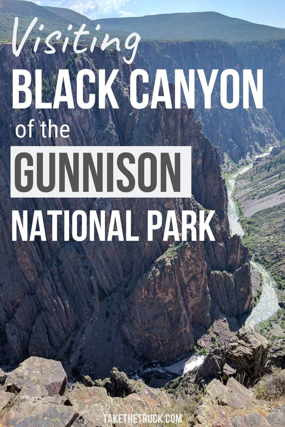
Colorado's Black Canyon of the Gunnison National Park

Black Canyon of the Gunnison National Park is one of Colorado’s hidden gems. It gets overlooked because Colorado has so much to offer, but Black Canyon is well worth the visit! In this post you’ll learn everything you need to know to enjoy your trip and appreciate this incredible national park.
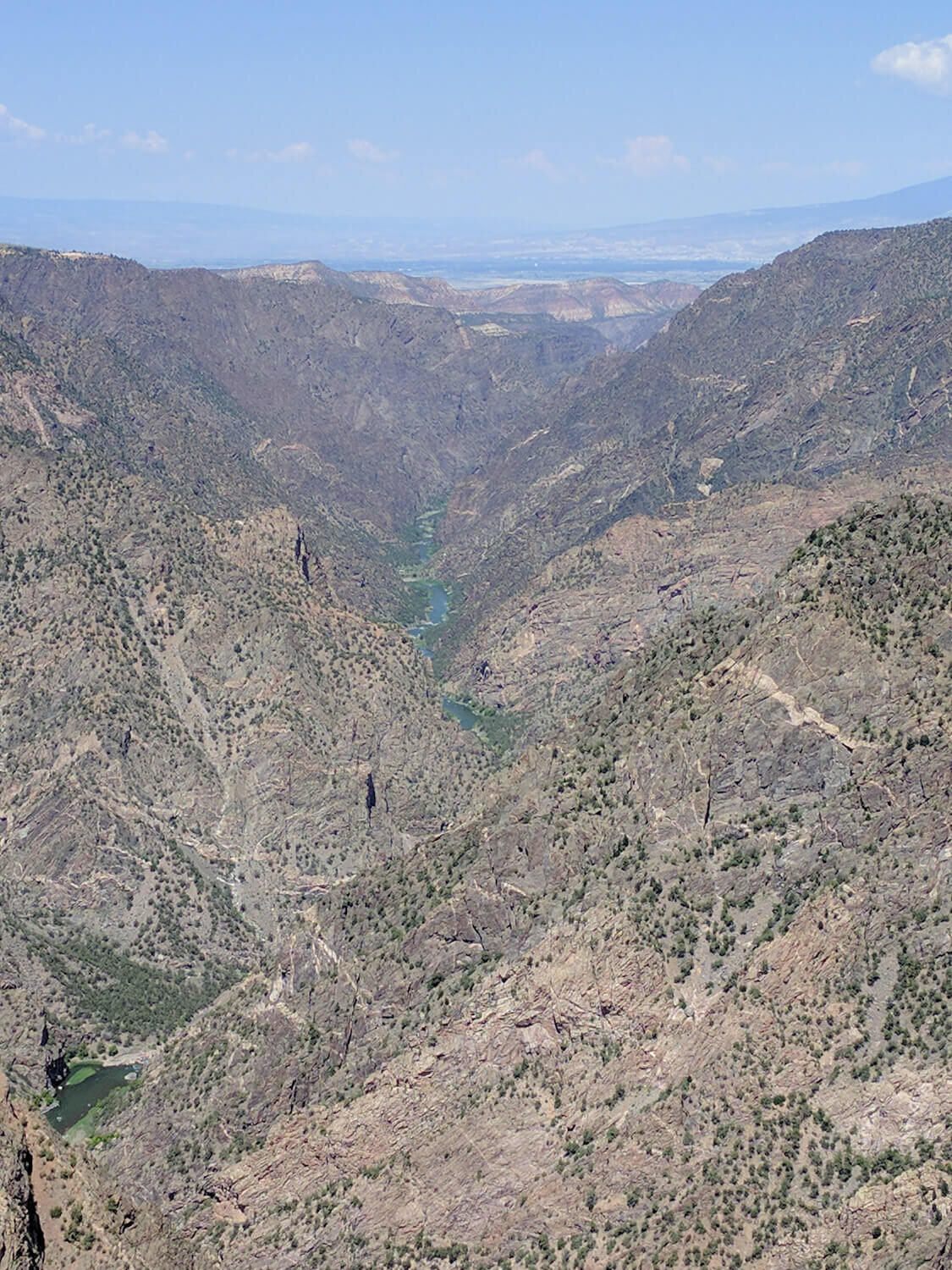
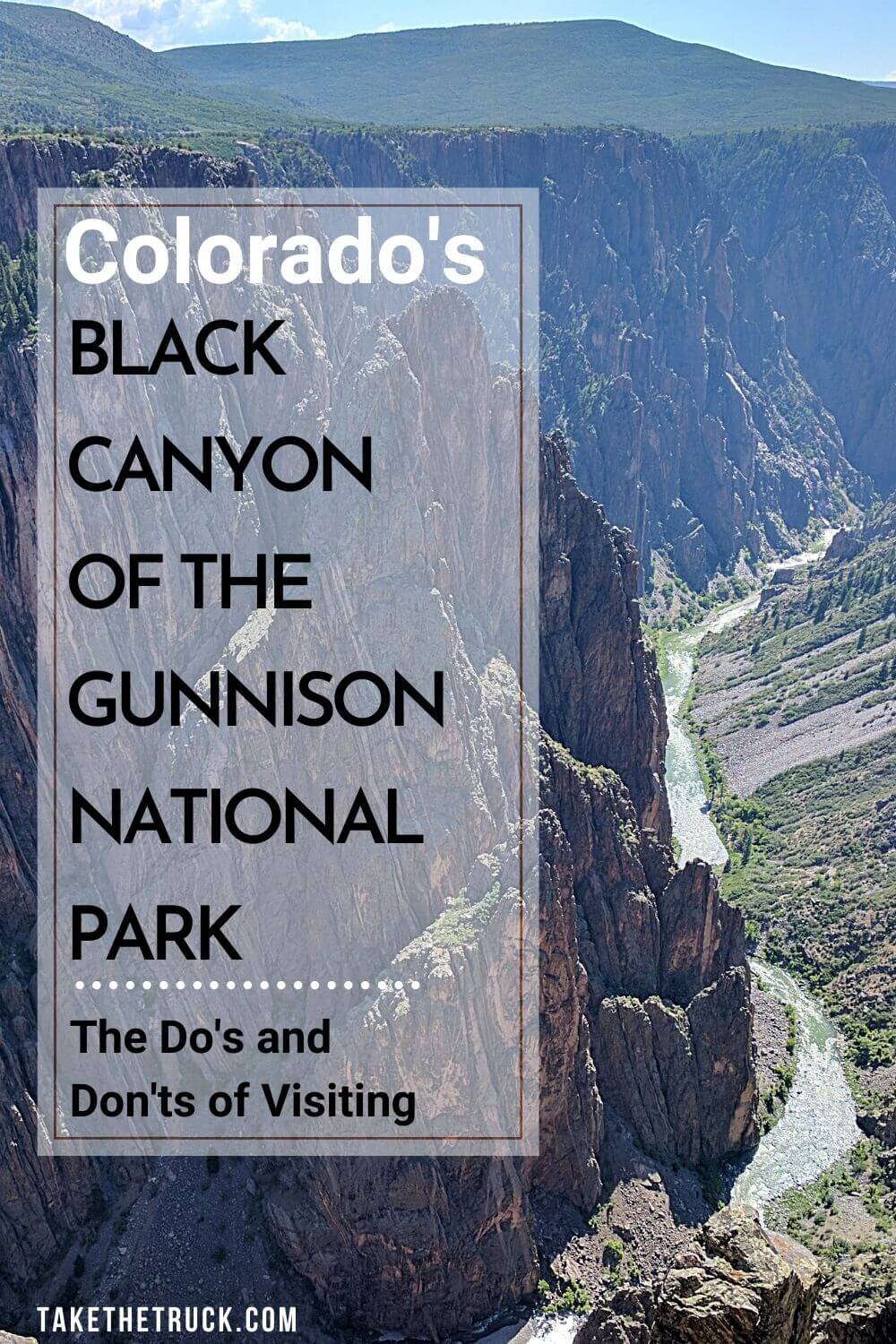
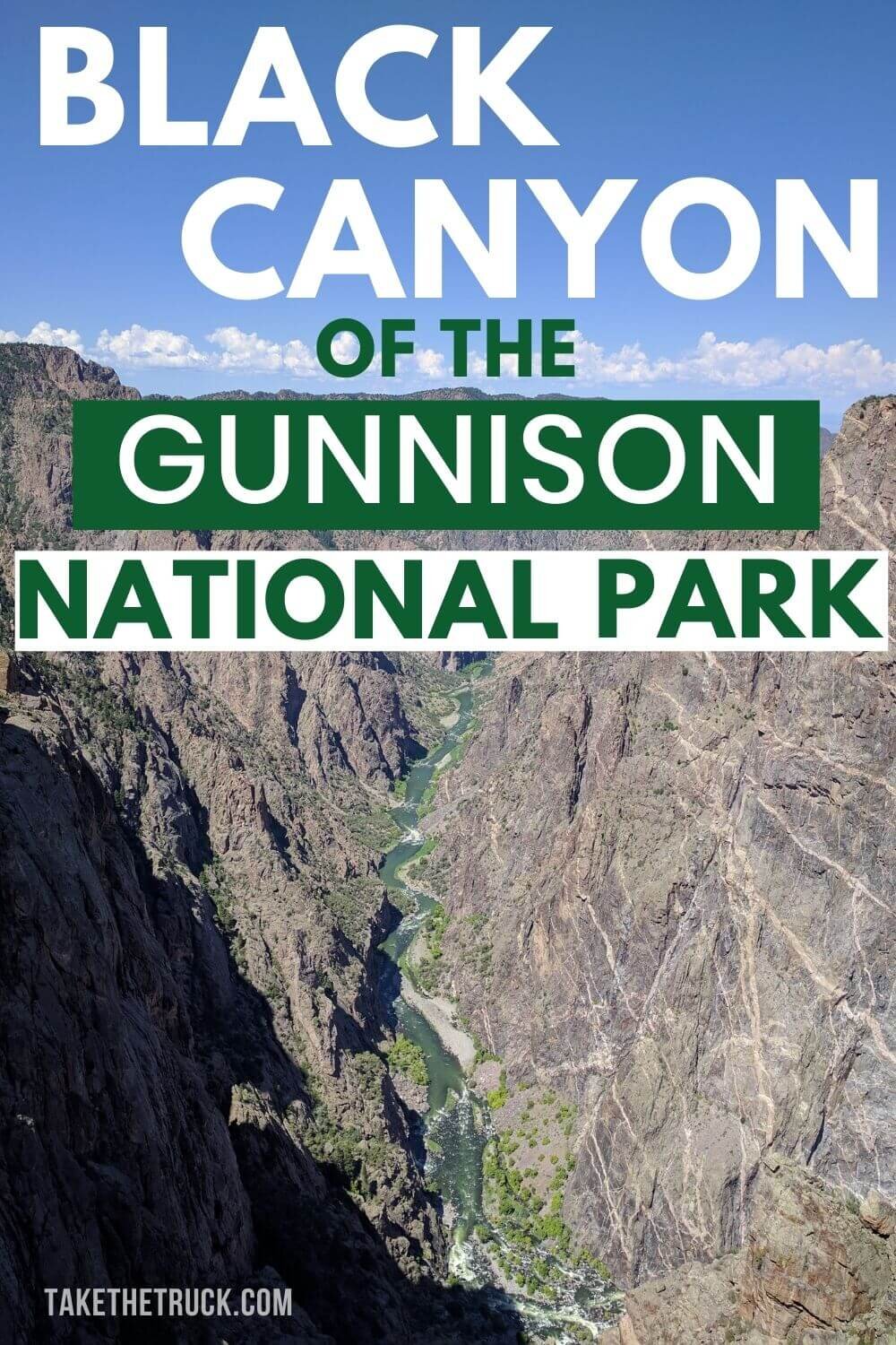
The canyon itself is 48 miles long, and the national park encompasses an awesome 14 mile stretch of that total length. It gets part of its name, Black Canyon, because the canyon is SO deep and narrow that sunlight only reaches to the bottom when the sun is directly overhead!
Here Are some Interesting Facts About Black Canyon National Park
2,722 Feet - deepest part of the canyon (at Warner’s Point)
Home of Painted Wall - tallest cliff in Colorado
40 Feet - narrowest section of the canyon at river level (at The Narrows)
Gunnison River - the Colorado River tributary that races through the canyon
Gunnison River (48 mile stretch) drops more elevation than the Mississippi River (1,500 mile stretch)
480 Feet - the shocking amount the river drops in a one 2 mile section
2 Billion Years Old - age of the Precambrian Era rock exposed by erosion
Crazy! In case you aren’t convinced to go yet, here’s a few more reasons:
Best Part - No one else is at Black Canyon!
To give some perspective, most all of the top 10 most visited national parks see 3-4 million visitors each year (with the most heavily visited receiving over 11 million/year!), while Black Canyon welcomes closer to just 300,000 visitors each year.
It’s located off the lesser traveled Highway 50 rather than an interstate, is quite small, and seemingly a lot of people just don’t know about it!
The Black Canyon National Park campgrounds are Really nice!

We found these campsites at Black Canyon to be much nicer than what we’ve experienced in other national parks.
They are closer to primitive sites (30 amp hookups only available at some spots, vault toilets), and we really enjoyed that they were a little more spaced out, had trees and greenery around them, were frequented by deer and other critters, and were just generally less crowded.
**Be considerate with your use of water. There are 3 spigots (one per loop) at the Black Canyon campground and they aren’t designed or intended to fill empty RV tanks! All the water gets trucked up, so arrive with water, and use it sparingly.
Visiting Black Canyon in the Summer can give you a break from the heat!
Because of the park’s elevation being 8,000 feet above sea level - a rise of about 2,500 ft from the nearby town of Montrose - this park provides a little break from the summer heat. We definitely weren’t completely cooled off, but also no longer felt like we were going to die. Doing these things also help us stay cool while camping in the heat!
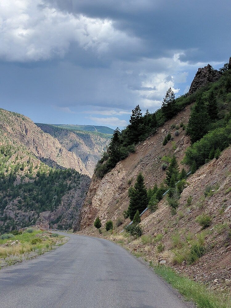
You can get to the Bottom of the Cayon without hiking!
East Portal Road, which takes you to the bottom of the Black Canyon, drops about 2,000 feet in approximately 5 miles, giving it multiple hairpin turns and steep 16% grades! Because of this, no vehicles (including trailers) over 22 feet are permitted.
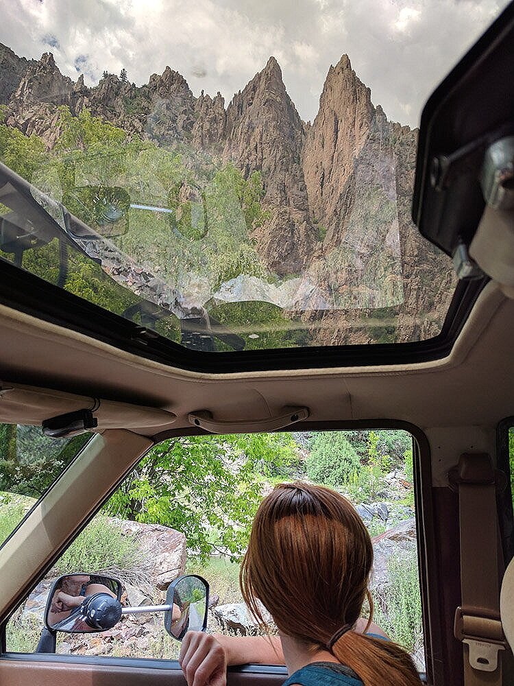
At the time we were hauling our old 5th wheel, but were able to leave it behind at the campground and enjoy seeing the river and views from the bottom up before heading on to the nearby Great Sand Dunes National Park.
During a future visit to Black Canyon of the Gunnison, we’d camp in the East Portal Campground for part of the visit in order to really enjoy and explore the river.
Black Canyon Offers Easy access to Jaw Dropping views!
Hiking isn’t required to get to these incredible views! There are a dozen scenic overlooks along the 7 mile paved road that runs along the South Rim of the Black Canyon.
We found it well worth visiting multiple overlooks - new breathtaking views and different vantage points!
Here’s where we stopped, in order from near the South Rim Campground and Visitor Center heading west:
Tomichi Point Overlook and part of Rim Rock Trail:
We were happy to have done this trail, but we wouldn’t recommend it if you’re crunched on time.
You’re mostly hiking on an established and level trail through brush, and the views are not as spectacular as in other places since the canyon walls are more V shaped rather than sheer cliffs.

Gunnison Point Overlook:
Located just behind the Visitor Center and provides a much more dramatic view of the canyon. Definitely walk down here after stopping at the Visitor Center!
Oak Flat Trail:
This is an approximately 2 mile loop located right by the Visitor Center and Gunnison Point. It is the only way to get slightly below the South Rim without taking on a hike down to the river - which really isn’t safe or accessible for young families.
Oak Flat Trail is marked as ‘strenuous’, but don’t let that worry you. It was easy peasy and we never felt like we were taking any sort of risk with our toddler in tow.
The trail takes you through wooded areas, past a rock outcropping, and eventually to an unmarked viewpoint of the canyon and river below before heading back towards the Visitor Center.

Pulpit Rock Overlook:
Stop here! This viewpoint gives you a great look at the river!

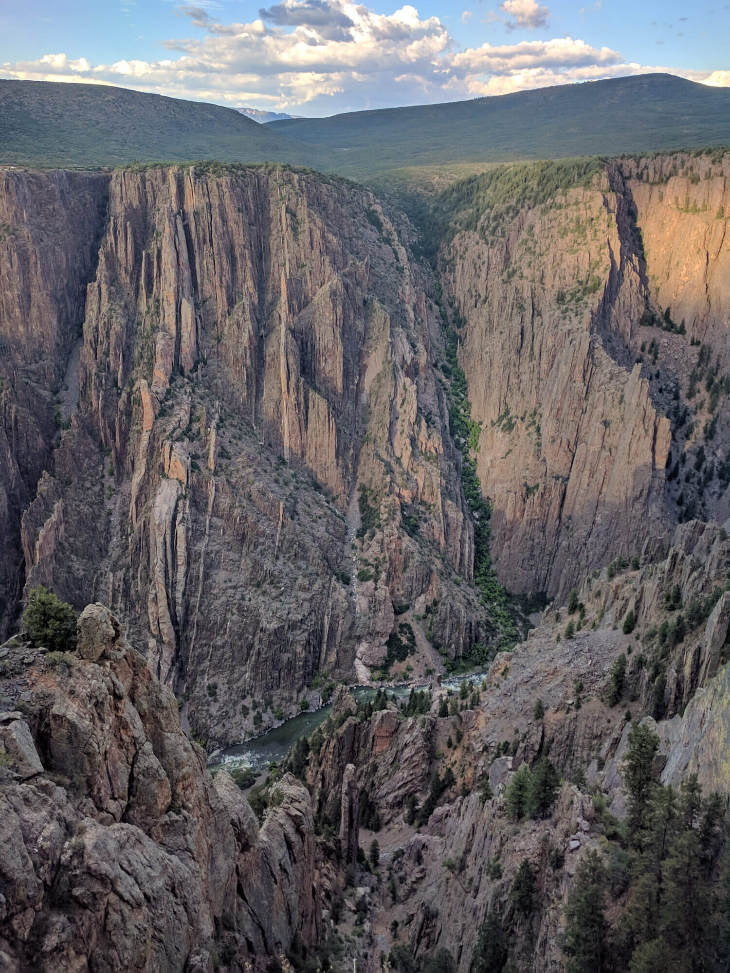
Chasm View:
Do not miss this one! Here the canyon is deeper than it is wide, and both the North and South Rim walls drop steeply.

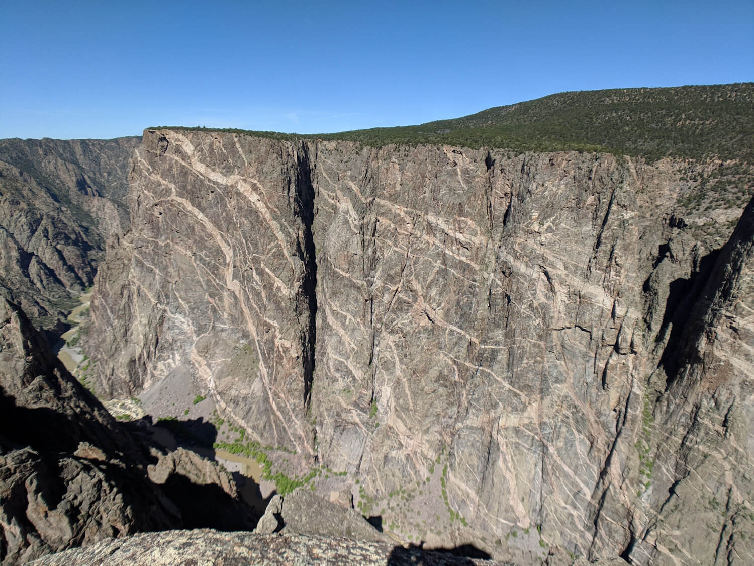
Painted Wall View:
This cliff, at 2,250 feet, is the tallest in Colorado, and the third tallest in the lower 48.
This viewpoint is a must see. You can stand right in front of Painted Wall, taking in its pink and white decorated surface.
Cedar Point:
An easy 0.6 mile path guides you to this overlook, where you’ll see that the canyon’s walls become less steep and more V shaped again.
Although less dramatic, this is a really beautiful view of the Gunnison River and surrounding greenery. You’ll also be able to see Painted Wall and some cool rock towers jutting up from the river.

High Point:
This is essentially the parking lot for the short hike out to the last stop on the South Rim - Warner Point. There are some shaded picnic tables to grab a bite to eat before heading down the trail.
Warner Point:
This 1.5 mile round trip hike takes you through wooded areas, gives you views of fields and a town far below, and provides intermittent glimpses of the canyon before arriving at Warner Point.
This is the deepest section of the canyon, although it may not feel like it because the walls are again more V shaped, and the viewpoint is situated back from the canyon. Although still striking, it felt less spectacular than many of the previous stops along the rim.
There is, however, a rewarding lookout for the not-so-faint-of-heart that can be accessed by a slightly worn path off to the left of Warner Point. Use your best judgement!
When standing at Warner Point looking out at the canyon you’ll be able to easily recognize where the path will take you, although we wouldn’t recommend scrambling out there with kiddos along.
The lookout offers a peaceful and secluded perch to take in this last section of Black Canyon from the South Rim.

Although Black Canyon of the Gunnison National Park is small enough to visit in a few hours, we would recommend camping for at least a night or two in order to enjoy a restful stay and really explore the area. An overnight would also give opportunity to see the canyon in different lighting during sunrise or sunset, and maybe visit the North Rim as well!
As always, thanks for reading! We’d love for you to join us by SUBSCRIBING for blog and travel updates!
And download our free printable national parks map and list!
Related Posts:
Pin me to revisit when you’re on your way to Black Canyon!


It would help us out if you could share this post with any other national park lovers!
Click the share buttons below!